


22mmk 1er jet

Lamartiniere
User GUIDE
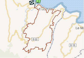

Length
18.8 km

Max alt
363 m

Uphill gradient
744 m
Km-Effort
29 km

Min alt
6 m

Downhill gradient
740 m
Boucle
Yes
Creation date :
2017-01-10 00:00:00.0
Updated on :
2017-01-10 00:00:00.0
6h02
Difficulty : Unknown

FREE GPS app for hiking
 SityTrail
IGN / Geographical institutes
SityTrail Plus
The world is yours!
About
Trail Walking of 18.8 km to be discovered at Martinique, Unknown, Le Lorrain. This trail is proposed by Lamartiniere.
Description
22mmk 2017
Positioning
Country:
France
Region :
Martinique
Department/Province :
Unknown
Municipality :
Le Lorrain
Location:
Unknown
Start:(Dec)
Start:(UTM)
708480 ; 1640940 (20P) N.
Comments